


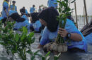


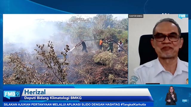
Indonesian Agency for Meteorological, Climatological and Geophysics (Badan Meteorologi, Klimatologi, dan Geofisika or simply BMKG) reminds all parties to anticipate the forest and land fire potentials in 2021. BMKG Deputy, Herizal, said that BMKG would keep monitoring the weather and climate change in Indonesia. This includes analyzing and informing the society and the stakeholders so they can do earlier mitigation.
“Mild and severe drought threats happen in June till September and October,” Herizal said in a virtual event “Forum Merdeka Barat 9 (FMB9) Media Discussion” headlined “Tangkas Tangkal Kahutla” (English: Deftly Prevent Forest and Land Fires), held on Monday (31/5/2021).
He also mentioned in February of this year, the hotspots in Aceh, North Sumatera and West Kalimantan would get worse but they would cool down in March 2021. As for Riau Province, the hotspots are getting hotter till March and will cool down in April 2021.
Based on BMKG’s observation in April and May of 2021, the rainfall is higher than its normal average. Herizal said that this could minimize forest and land fire threats. Wet climate doesn’t make peat water level decreased.
This year, BMKG predicted that the dry season would get better. Herizal requested that the control and mitigation measures of the forest and land fire potential of 2021 be encouraged. “Based on our observation, 55 percent of season zone areas have already been in dry season,” he said.
Most of the areas are in East Nusa Tenggara, West Nusa Tenggara, Bali as well as most regions in Java, South Sumatera, Aceh, South Kalimantan and Papua.
Herizal said that if the region is green-colored, this means the rainfall is still high. However, when it is brown or red, caution is needed.
Lancang Kuning App to Suppress Forest Fire Area
In the meantime, Deputy Governor of Riau Province, Edy Nasution, said that Riau used dashboard application, Lancang Kuning Nusantara, which claims to be able to suppress the forest fire area. According to him, by using the control panel application, the currently appearing hotpots will be detected in real-time.
“So, where there is a new hotspot, we can already map where the hotspot is. Then, we directly instruct available personnel to overcome the hotspot,” he said.
He also mentioned that the application developed by the Riau Regional Police gave positive impacts. The reason is his region is able to suppress larger forest fires by using the application. Besides using the application, Riau Province also has strategy to prevent and overcome forest and land fires.
What happened six years ago motivated the use of Lancang Kuning Nusantara. In 2015, smog from the forest and land fires that happened in Riau caused economic slowdown, airport closure, stoppage of school activities.
“Fire area in 2014 was actually larger. However, in 2015, Forest fires also happened in South Sumatera and Jambi which caused bigger fire effect in Riau Province,” he said.
As for 2019, according to Edy, the case was similar to what happened in 2015. What sets them apart is forest fires in 2015 took less time to stop.
Referring to that and also following the instruction from President Joko Widodo, Riau Provincial Government has done early detection. In 2020, Riau Provincial Government carried out patrols with Indonesian National Army, Indonesian National Police, Ministry of Environment and Forestry and other relevant agencies.
Writer: Dewi Purningsih
Translated by Barli Kifli